simple facts
Where is it? Chicago, Illinois [41.85802928, -87.57938545]
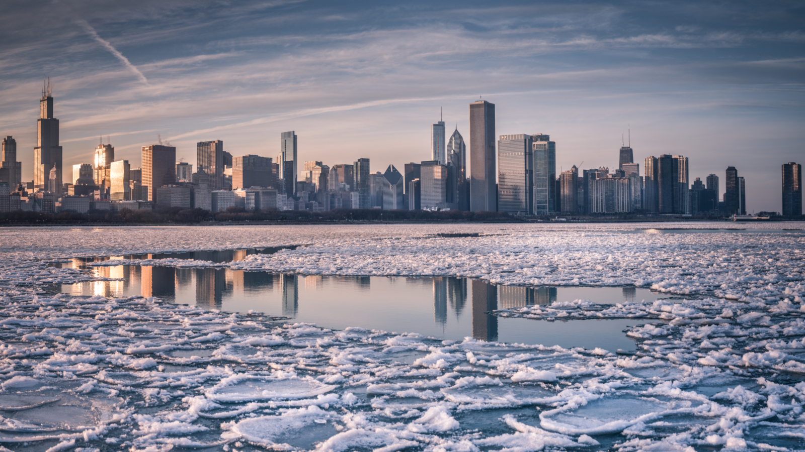
What is in the photo? Swirling ice on the shores of Lake Michigan
Which satellite took the photo?Landsat 8
When was it taken? January 24, 2025
This striking satellite photo shows a rippling ribbon of ethereal ice swirling like a turbulent cloud on the surface of Lake Michigan, alongside a snow-covered Chicago. Experts say the winter scene occurred during an extremely cold wave caused by a shift in the polar vortex.
The greater Chicago area is home to approximately 9.5 million people and is located near the southernmost tip of Lake Michigan, the third largest of the Great Lakes, covering approximately 22,300 square miles (57,750 square kilometers) across Illinois, Indiana, Wisconsin, and Michigan.
From January 19 to January 24, 2025, the Windy City and other parts of the eastern United States experienced an unusually cold snap. It was caused in part by the sudden expansion of the polar vortex, a persistent region of cold, low-pressure air that circulates in the stratosphere above the North Pole. During this period, temperatures in Chicago dropped to -33 degrees Fahrenheit (-36 degrees Celsius), according to the National Oceanic and Atmospheric Administration (NOAA).
you may like
This sudden drop in temperature, combined with strong offshore winds, caused ice to form around the coastline and be pushed outward, creating beautiful swirls. According to NASA’s Earth Observatory, these flowing ribbons look like clouds from above, but they are entirely ice.
According to NOAA’s Great Lakes Environmental Research Laboratory (GLERL), at the time the satellite images were taken, about 20 percent of Lake Michigan was covered in ice, slightly above average for this time of year.
Although lake ice is most common in January, Lake Michigan ice coverage typically reaches its peak in February or March. Also, uniform sheets of ice are more common than the flowing patterns seen in this image.
In this case, black, wispy ice near the lake shore likely accumulated on thick offshore structures with rough edges that appeared whiter when viewed from above, GLERL ice climatologist Jia Wang told the Earth Observatory.
The other Great Lakes were also affected by the cold snap, with up to 80% of Lake Erie’s surface frozen over, according to GLERL. Erie’s ice was so thick and appeared so quickly that a Canadian freighter was trapped for three days, according to the New York Times.
This isn’t the first time satellite images have revealed something unusual about Lake Michigan. In 2024, using aerial photography, researchers identified more than 40 mysterious craters dotting the lakebed, but there is currently no definitive explanation.
Low temperatures and strong winds around Chicago can lead to other unusual winter sights, such as the strange chess piece-like sand sculptures along the Lake Michigan coast known as “hoodoos,” formed when chunks of frozen sand are exposed to strong wind gusts.
For more amazing satellite photos and astronaut images, check out Earth from the Space Archives.
Source link