Geologists may have finally solved a long-standing mystery surrounding the Colorado River’s largest tributary. This tributary appears to have been flowing uphill against gravity when it first formed.
The Green River originates in Wyoming and joins the Colorado River in Utah’s Canyonlands National Park. About 8 million years ago, rather than flowing around geological formations, the Green River flowed through the 13,000-foot (4,000-meter) high Uinta Mountains in northeastern Utah and northwestern Colorado. But in a new study, researchers argue that this would not be possible without a mechanism to lower the mountain.
you may like
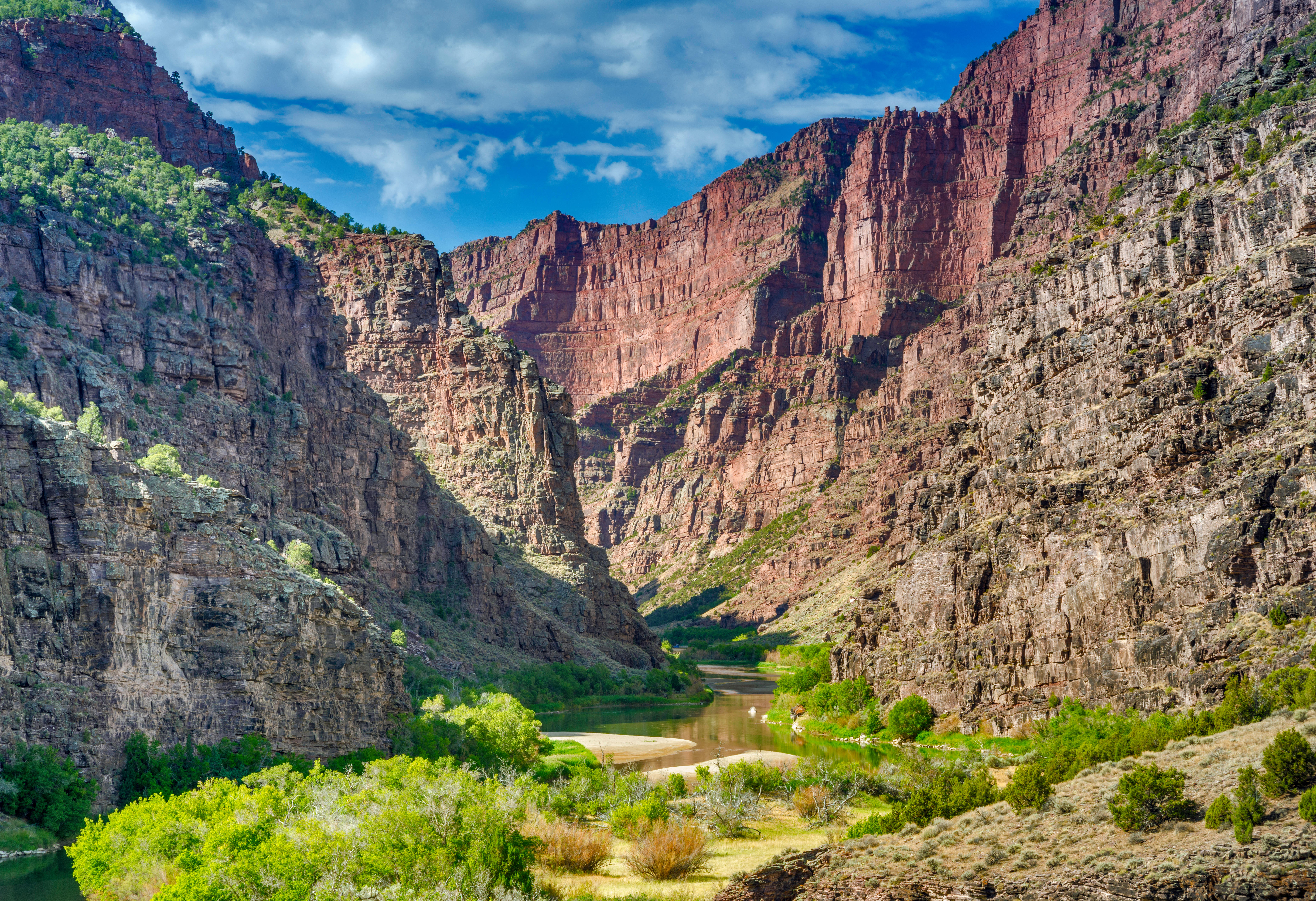
The Green River flows through the Lodore Valley, eroding the canyon with walls 700 m (2,300 ft) high. Smith said there have been two competing theories trying to explain why the river flowed the way it did, but neither was particularly convincing.
One hypothesis is that the Yampa River south of the Uinta Mountains cut north through this formation, creating a channel to the Green River. This would have required an enormous amount of force, but the Yampa River is not very large, so such a force is unlikely. “If this was to be believed, you would expect a huge valley running through all the mountain ranges, but that’s not the case,” Smith said.
Another theory is that sediment buildup caused the Green River to temporarily rise, thereby carving a path for the river to cross the Uintas and through the Uintas, but the available evidence does not support this either. “The sediments we find here are not as high as in the Lodore Valley,” Smith said.
Instead, the researchers behind the new study suggest that the Uinta Mountains have sunk to the point where the Green River could flow above them. Researchers believe that a phenomenon called “lithosphere drip” may have pulled the mountains together, and then a rebound effect caused the terrain to rise upwards again, resulting in the terrain we see today.
The findings were published on Monday, February 2, in the Journal of Geophysical Research: Earth Surface.
Lithospheric drips are dense regions that can form beneath the mountains where the Earth’s crust and upper mantle, the planet’s layers between the crust and outer core, meet. The weight of the mountains increases pressure at the base of the Earth’s crust, forming minerals like garnet that are heavier than mantle rocks. Eventually, these minerals form clumps that trickle down from the bottom of the Earth’s crust, dragging mountains down and lowering their elevation at the Earth’s surface.
The dripping of the lithosphere causes a rebound effect when it eventually separates and sinks into the mantle. Although the concept of these infusions is relatively recent, evidence of them has been found in several locations, including the Andes. “It can happen anywhere that mountain ranges are formed, and it can happen at any time,” Smith said.
you may like
A clear sign of lithosphere dripping is the bull’s-eye pattern of ridges on the Earth’s surface. Smith and his colleagues modeled geological processes based on unusual river profiles in the Uinta Mountains and discovered such patterns.
The researchers also analyzed seismic tomography images (3D maps of the Earth’s interior created using seismic waves) obtained in previous studies. They found clumps very similar to old lithospheric drips 120 miles (200 kilometers) deep in the mantle beneath the Uintas, providing strong evidence for this mechanism, Smith said.
The researchers then used the observed depth and size of the drip to calculate when it would break away from the floor of the Uinta Mountains. The researchers found that it likely escaped between 2 million and 5 million years ago, which matched model predictions about when the mountain rebounded and matched estimates of when the Green River first broke through the mountain.
Drips lowered the mountains so much that they became the “path of least resistance,” Smith said. Once the Green River began flowing beyond the Uintas River, it continued to carve into the mountains, creating structures like the Lodore Valley, he added.
Other experts not involved in the study suggested that this explanation could finally solve the long-standing mystery.
Mitchell McMillan, a research geologist at the Georgia Institute of Technology, said lithospheric dripping is a plausible explanation for why the Green River flows the way it does.
“The most interesting thing about this study is that it uses clues from the Earth’s surface to understand processes in the mantle and how they affect mountainous belts,” McMillan told LiveScience via email. “Whether or not the drip hypothesis is ultimately correct here, this study is a valuable demonstration of such an approach.”
Smith, A., Fox, M., Miller, S., Morris, M., and Anderson, L. (2026). Drip of the lithosphere caused the merger of the Green and Colorado Rivers. Geophysical Research Journal: Earth Surface. https://doi.org/10.1029/2025JF008733
Source link