Eight cities on the U.S. East Coast are at high or very high risk of “extreme” flooding based on current scenarios, with New York and New Orleans facing some of the greatest risks, a new study has found.
Fifty percent of New York City’s population (approximately 4.4 million people) is most likely to be affected by flooding, and 47 percent of the city’s buildings are currently at high risk of extreme flood damage in the event of a major flood, according to a flood risk assessment published in the journal Science Advances on Wednesday (April 22).
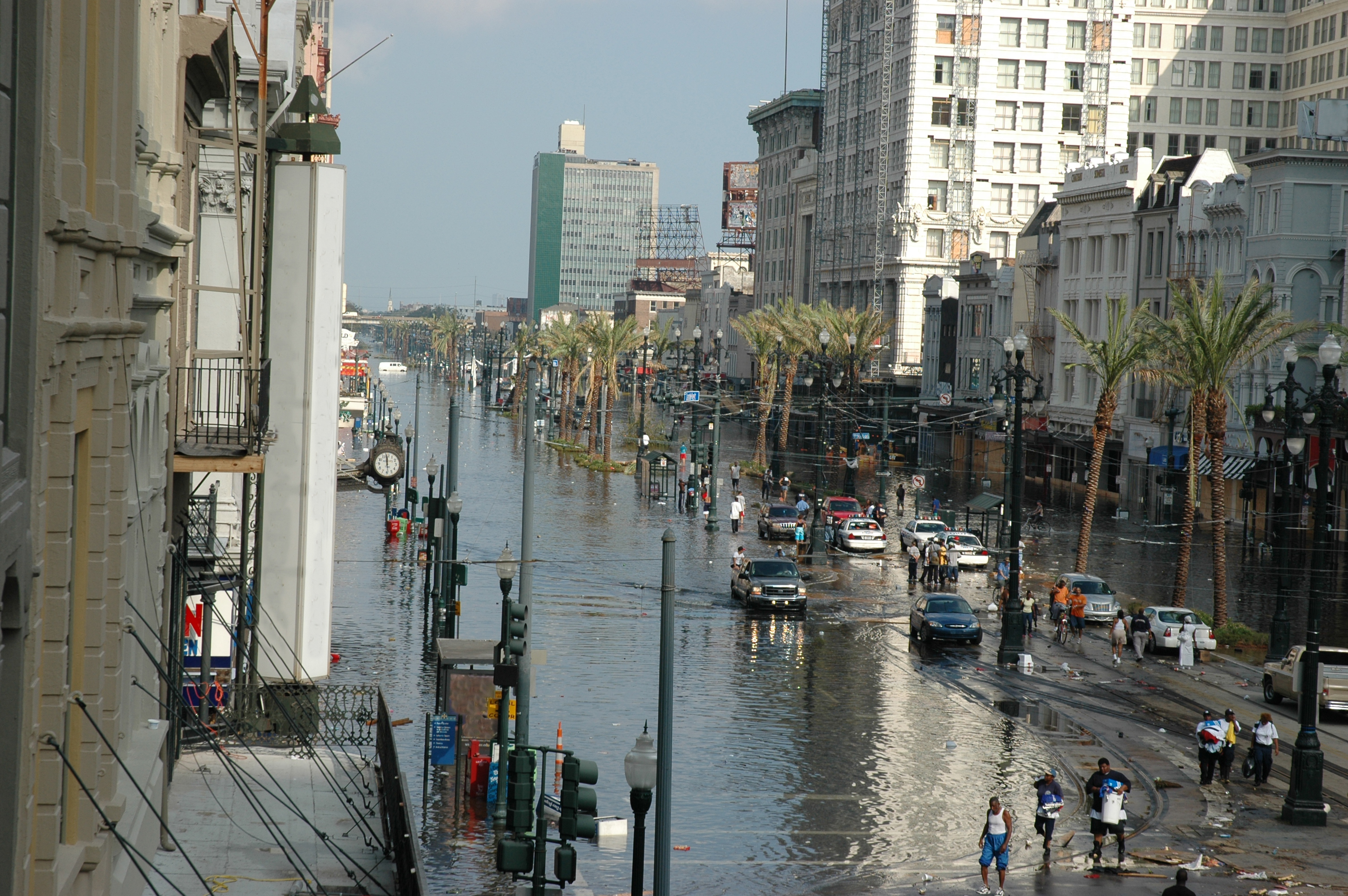
New Orleans faces the greatest relative risk, with 98% of its population (approximately 375,000 people) and 99% of its infrastructure at high risk of extreme damage, according to the study.
you may like
The other six cities mentioned in the report are Houston; Miami; Norfolk, Virginia; Charleston, South Carolina. Jacksonville, Florida. and Mobile, Alabama.
The increased threat and damage levels these cities face are due to their low altitude, high population density, poor drainage, building height, rainfall, and proximity to water. The study authors urged policy makers to work with local stakeholders and utilize nature-based solutions alongside structures such as sluices, embankments and embankments to reduce flood risk.
“Such policies should limit further urban development in high-risk zones while promoting the systematic introduction of nature-based solutions,” the authors write.
flood risk
Floods are the costliest natural disaster in the United States, costing billions of dollars annually. By 2050, sea levels along the continental U.S. coastline are projected to rise by up to 1 foot (0.3 meters), and climate change is also increasing post-hurricane flooding along the East Coast.
Approximately 30% of U.S. Gulf and Atlantic coastal counties are at high risk of flooding, and it is important to understand which measures most effectively prevent flood damage, the authors said in their study.
Using historical flood damage data from the Federal Emergency Management Agency, researchers used machine learning to assess flood risk along the U.S. East Coast. This data provides a bird’s-eye visual record of the damage to buildings associated with recent major flooding events, such as Hurricane Isaac in 2012 and Hurricane Irma in 2017. The study classified buildings that were completely destroyed as “extreme flood damage.”
The team then collected data on 16 flood risk factors and created a flood risk map that uses these risk factors to predict exposure to flood damage. Flood risk factors include natural hazards such as distance from water and elevation. Exposure factors such as population density. and population vulnerability, such as the proportion of people living in poverty.
What to read next
Based on these factors, the model generated a “flood risk index” of probability scores ranging from “very low” to “very high” risk. This allows us to estimate which coastal cities are most at risk of flooding leading to extreme flood damage. The research team calculated the number of people and buildings exposed to this damage.
The results show that New York City and New Orleans share the “harsh reality” of being “high-flood-risk cities,” the authors said in the study. Approximately 4.4 million people and more than 215,000 buildings in New York City could face extreme flooding. More than 98% of New Orleans’ population and buildings face similar damage.
Houston and Mobile, Alabama, are also at high risk of extreme flooding and, like New York and New Orleans, these cities require “priority consideration from policymakers,” the study authors wrote.
The authors highlighted several ways that could potentially reduce flood damage. For example, parking lots built with impermeable concrete should be replaced with grass tiles to allow the soil to absorb water, and wetlands and river floodplains should be restored and connected to drainage systems such as gutters to quickly remove water from the city.
Source link