
Scientists have mapped the rock beneath Antarctica’s giant ice sheet in unprecedented detail, revealing the hidden structures that form glaciers.
The ice sheet covers more than 5.4 million square miles (14 million square kilometers) and covers the mountains, valleys, lakes and basins beneath it, according to a new study published Thursday (January 15) in the journal Science.
you may like
However, much is unknown about the landscape beneath the ice, as ground and aerial surveys are difficult in this area. Scientists often extrapolate information between distant or irregular survey points, which can miss, for example, rock troughs that guide ice flow.
In the new study, researchers addressed this gap by combining high-resolution satellite images of the ice sheet surface with measurements of ice thickness and ice flow analysis based on the physics of how ice flows over bedrock. Scientists combined these data to create a continent-wide map of Antarctica’s topography beneath the ice.
Image 1/2
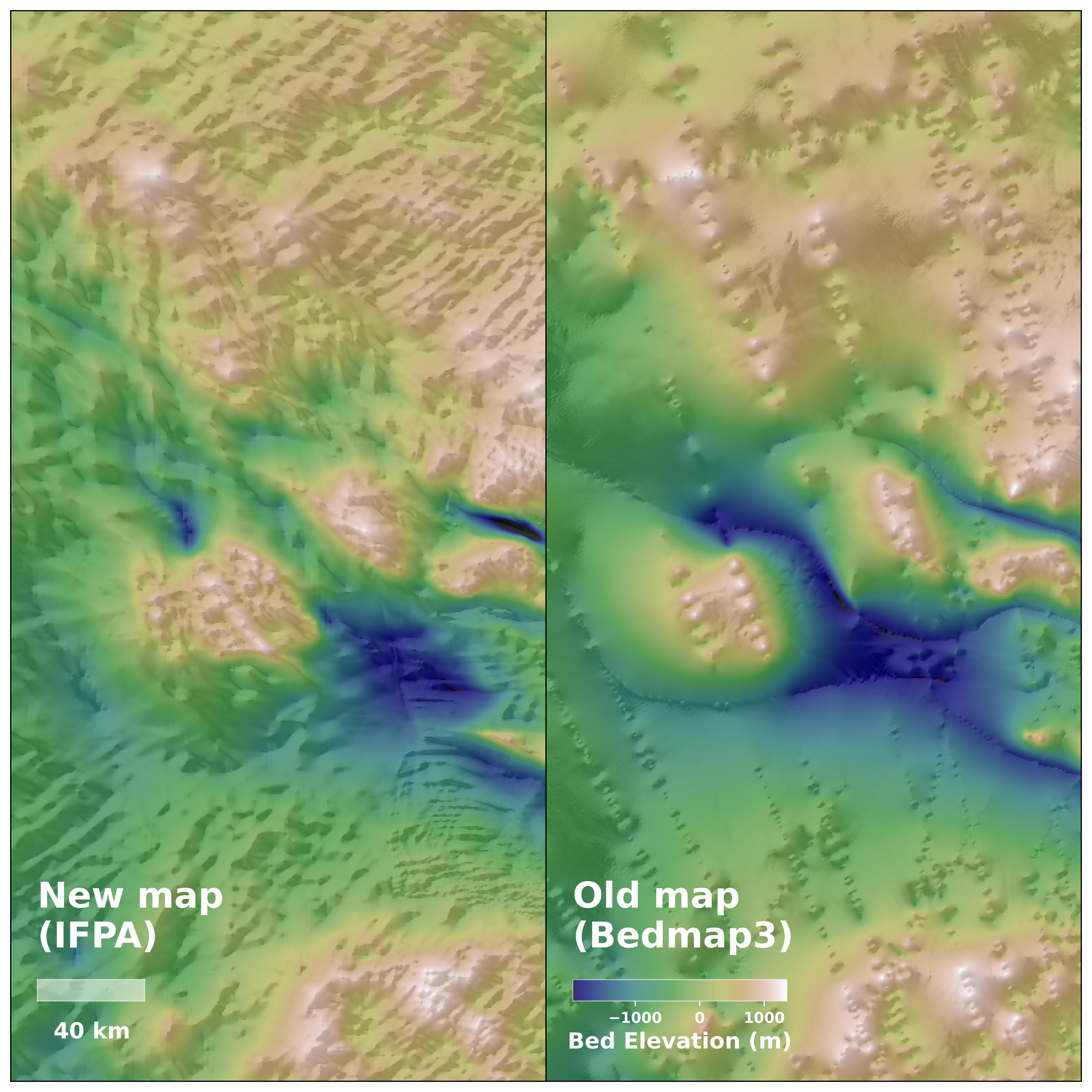
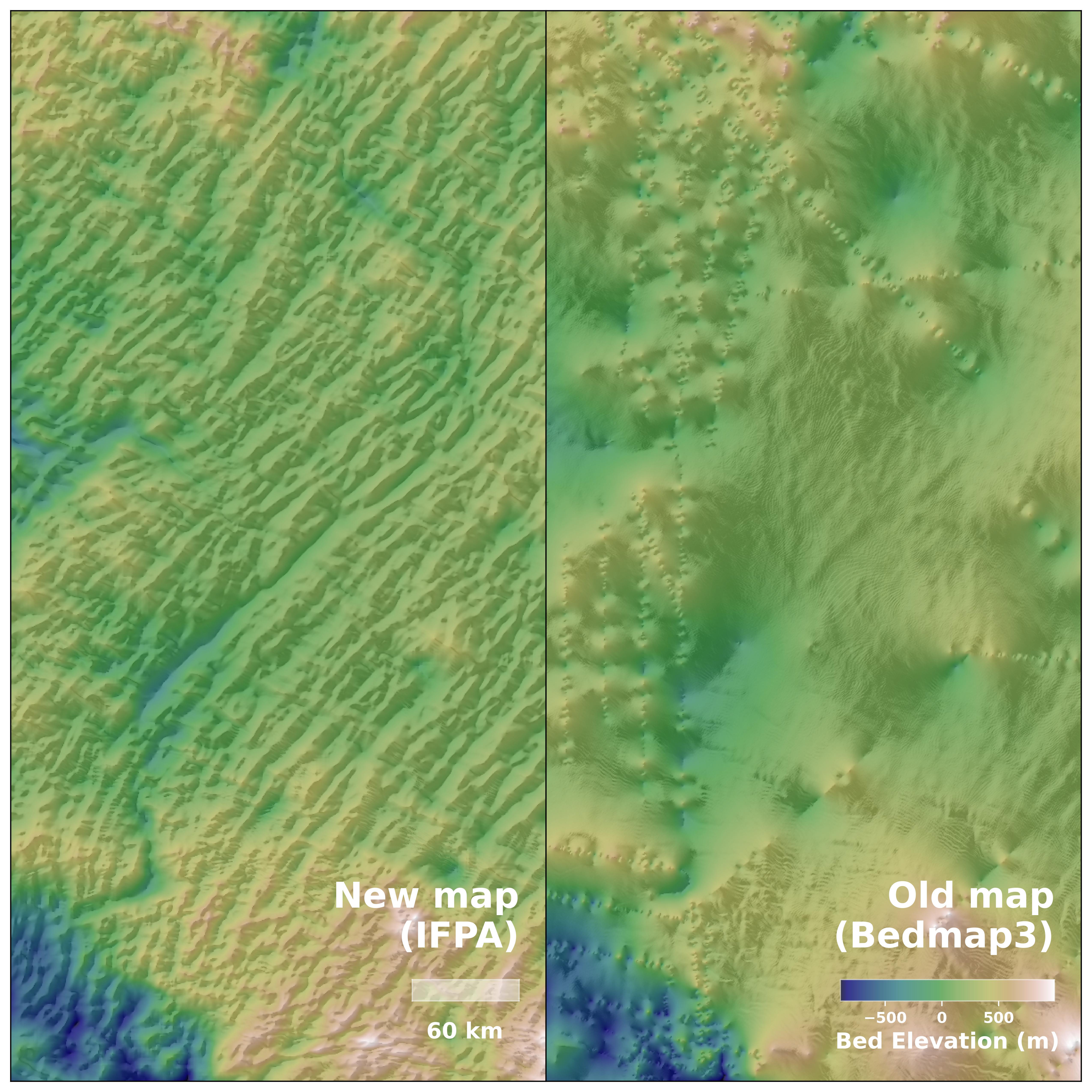
This extensive map reveals previously unknown or scientifically obscure features 1.2 to 18.6 miles (2 to 30 kilometers) beneath the ice sheet. For example, they could be remnants of landforms that predate the ice sheet, such as hundreds of miles of river channels.
The map also reveals sharp changes between upland and lowland topography, suggesting tectonic boundaries. In some areas, where previous aerial surveys had predicted a landscape of ancient ice-covered rivers, new maps actually identified deep valleys beneath.
This map allows scientists to observe how ice sheets have evolved and interacted with the underlying landscape. By visualizing the processes that affect these glaciers, we can improve ice sheet models and more accurately predict ice melt and sea level rise due to climate change.
Antarctica Quiz: Test your knowledge about Earth’s frozen continent
Source link