The world’s newest monitor in the fight against climate change is now in orbit around the Earth.
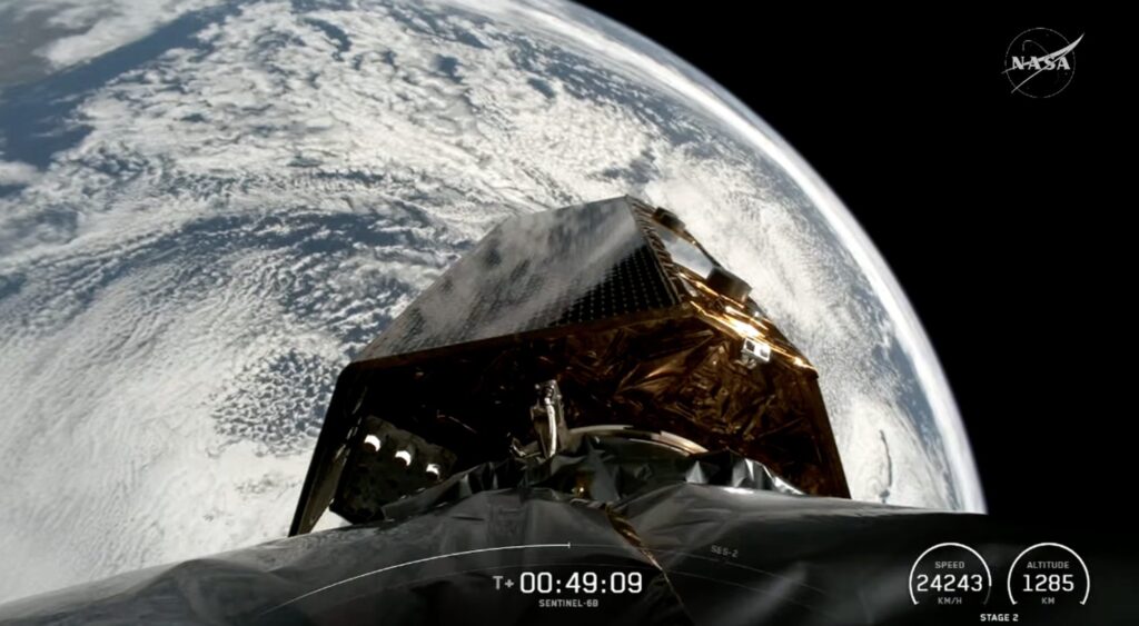
The Copernicus Sentinel 6B satellite was launched today and embarked on a mission to monitor sea level rise with unprecedented precision.
As rising sea levels threaten millions of people living along coastlines, this advanced satellite will continue decades of efforts to track changes in the height of the world’s oceans, critical data for shaping climate policy and protecting vulnerable communities.
Smooth launch marks a new chapter in sea level monitoring
Sentinel-6B lifted off from Vandenberg Space Force Base in California aboard a SpaceX Falcon 9 rocket at 06:21 CET.
Within an hour, the satellite reached orbit, and at 07:54 CET, ESA’s European Space Operations Center in Germany confirmed that it had received the first signal via the Inuvik ground station in Canada.
This demonstrated that Sentinel-6B is fully operational and ready to continue its critical mission.
Continuing the tradition of ocean observation
Sentinel-6B follows in the footsteps of Sentinel-6 Michael Freilich, which launched in November 2020.
Both satellites are part of the Copernicus Sentinel 6 mission, the world’s main reference for measuring sea level height from space.
The mission builds on decades of observations that began with the Topex-Poseidon satellite in the early 1990s and continued through the Jason satellite series.
These ongoing records have become an essential tool for understanding long-term sea level rise, a phenomenon that threatens millions of people living along coastlines around the world.
Advanced technology for accurate measurements
Equipped with a state-of-the-art radar altimeter, Sentinel 6B measures sea surface height by timing radar pulses sent to Earth and back to the satellite.
Precise satellite positioning allows scientists to calculate sea level heights with unprecedented accuracy. In addition, an advanced microwave radiometer provided by NASA compensates for atmospheric water vapor to ensure the accuracy of measurements.
Sentinel-6B will not only collect sea level rise measurements, but also important operational data such as wind speed and significant wave height. These observations feed into near real-time ocean forecasts, benefiting shipping, weather forecasting, and coastal management.
best international cooperation
Sentinel-6B is part of the European Union’s Copernicus program, but is an example of international cooperation.
The mission brings together ESA, the European Commission, Eumetsat, NASA, NOAA and France’s CNES, bringing together expertise, technology and resources to deliver the highest quality oceanographic data.
Simonetta Celli, ESA’s Earth Observation Program Director, explained: “Cooperation between partners is key in a mission like Sentinel 6, and we thank everyone involved in the development, launch, and operation of this remarkable satellite.”
“This achievement shows what can be achieved when international organizations and industry work together towards a common goal.
“Sentinel-6B will ensure we continue to collect the high-precision data needed to understand our changing climate, protect our oceans, and support decisions that protect coastal communities around the world.”
Why ocean monitoring is important
Tracking sea level rise is more than just a scientific endeavor; it has significant societal implications.
Rising sea levels will cause coastal flooding, erosion and salt water intrusion, threatening infrastructure, ecosystems and populations. Long-term monitoring can help governments plan climate adaptation strategies, from sea walls to managed refuges.
Satellites like Sentinel-6B are critical because they provide a global perspective that cannot be achieved with tide gauges alone.
Continuous measurements allow scientists to detect subtle trends and seasonal fluctuations and provide early warning of accelerating sea level rise. Additionally, satellite data can enhance climate models and help policy makers make informed decisions about mitigation and disaster preparedness.
Next steps for Sentinel-6B
Currently, Sentinel-6B is managed by Germany’s ESA’s Mission Control throughout its “launch and early orbit phases.” Once this phase is complete, operational management will be transferred to Eumetsat, which will oversee the satellite’s long-term data collection and distribution.
With Sentinel-6B operational, the Copernicus Sentinel-6 mission will ensure the global community has the tools to monitor the ocean with unparalleled precision and continue decades of records essential to understanding our changing planet.
Source link

