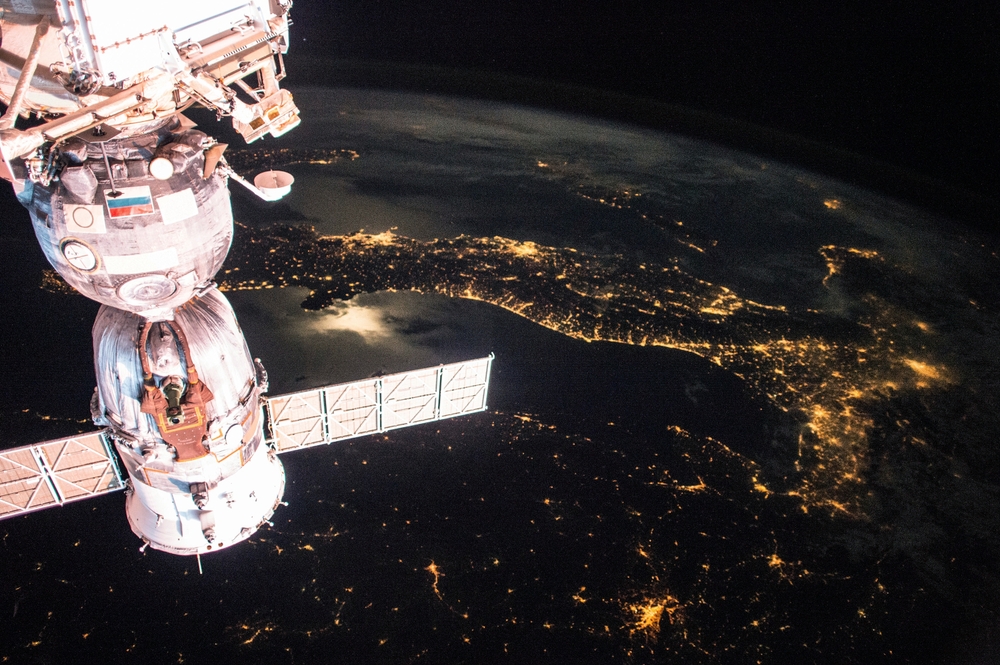
In an age defined by climate change, biodiversity loss, and degradation of natural resources, Earth observation has emerged as the basis for environmental protection.
With satellite technology, remote sensing, and advanced data analytics, Earth observation allows scientists, policymakers and conservationists to monitor and respond to environmental change on a global scale.
From tracking shrinking forests to monitoring ocean health, this technology is revolutionizing how we understand and protect our planets.
See nature from orbit
At its core, Earth observation involves collecting data about Earth’s physical, chemical and biological systems, primarily using satellites.
These space instruments provide bird’s-eye views of the planets, capturing high-resolution images, temperature patterns, atmospheric conditions, and more.
Agency such as NASA and the European Space Agency (ESA) deploy satellite constellations to provide real-time insights into the rapidly changing environment of the Earth.
These observations are not just about taking beautiful photos from space. They are essential for detecting invisible human changes in the ground.
Repeated pass through the same area allows satellites to reveal trends, patterns and anomalies in vegetation, water bodies and atmospheric composition over time.
Tracking deforestation
Forests are key carbon sinks and biodiversity hotspots, but are subject to constant threats from logging, agriculture and wildfires. Earth observation allows for accurate monitoring of deforestation and forest degradation around the world.
For example, the use of satellite monitoring in Brazil has contributed to the implementation of Amazon’s deforestation controls. Generate deforestation alerts in near real-time through platforms such as the Global Forest Watch, powered by NASA and ESA satellite data.
This will allow governments, NGOs and communities to take prompt action against illegal logging activities.
High-resolution images often updated daily or weekly will allow even small-scale land use changes to be identified. Machine learning algorithms further enhance this data, flag suspicious activity and help predict future deforestation risks.
Sea and coastal protection
Covering more than 70% of the Earth’s surface makes the oceans more important to life, but become increasingly vulnerable to pollution, overfishing and climate impacts such as sea level rise.
Earth observations play an important role in monitoring marine health and providing data on sea surface temperature, chlorophyll concentration (indicating phytoplankton), coral bleaching, and marine pollution.
Satellites such as the Copernicus program Sentinel-3 and NASA’s Aqua Mission are specially designed to track ocean conditions. These systems can detect oil spills, algae flowers, and sediment feathers. This is an event that is often difficult to assess from a ship or coastline.
Coastal areas where land meets the ocean are particularly dynamic and sensitive to environmental changes. Satellite images are used to map coastline erosion, monitor mangrove losses, and assess damage caused by storms after extreme weather events, thereby aiding disaster preparation and recovery.
Biodiversity under the lens
The loss of biodiversity is one of the most significant environmental challenges of our time. Traditional methods of wildlife monitoring, such as field surveys and camera traps, are labor intensive and limited in scope.
Earth observations provide a complementary and large-scale approach to tracking biodiversity and habitat integrity.
Although satellites cannot directly count individual animals, they can map habitats, monitor land cover changes, and assess ecosystem health.
For example, satellite data can help model species distribution by linking observed habitat variables with known ecological requirements.
In Africa, conservationists use Earth observation to map elephant moving corridors to predict conflict zones for humans. In marine environments, satellites detect coral reef ecosystem shifts and track the spread of invasive species.
As part of the United Nations’ global biodiversity framework since 2020, Earth observation data is increasingly integrated into biodiversity indicators and national reports.
The future of Earth’s stewardship from space
The future of Earth observation is bright and closely linked to the evolution of satellite technology, artificial intelligence and global cooperation.
With the rise of miniaturized satellites (Cubesats), the Earth can now be viewed more frequently and at finer resolutions than ever before.
AI and machine learning continue to play a vital role, automate the analysis of vast datasets and make Earth observations more accessible to non-experts. These tools can detect anomalies, predict environmental changes, and provide early warnings for natural disasters.
International efforts such as the Earth Observation Group (GEO) and the Earth Observation Satellite Committee (CEO) are promoting data sharing and capacity building, ensuring that developing countries can benefit equally from satellite technology.
Ultimately, Earth observations can help us achieve our global environmental goals, from the Paris Agreement to the United Nations Sustainable Development Goals. This provides the scientific foundations needed for evidence-based policy making and global environmental management.
From orbit, our planet tells a story of change. Thanks to advances in Earth Observation, we are now more equipped than ever before, listening, learning and responding.
As environmental challenges grow, this technology provides not only a window into the health of the planet, but a powerful tool to protect it.
Source link

