
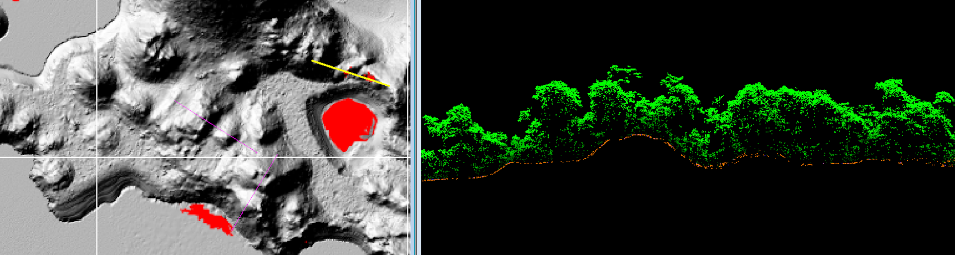
Imagine an airplane hurtling across the sky at hundreds of miles per hour, firing millions of laser pulses into a dense tropical forest. The goal is to create a detailed map of thousands of square miles, including the ground beneath the canopy, within a few days.
Once the stuff of science fiction, aerial lidar (light detection and ranging) is changing the way archaeologists map archaeological sites. Some have hailed this mapping technique as an innovative research method.
you may like
The dark side of LIDAR
Lidar is a remote sensing technology that uses light to measure distance. The aviation system works by firing millions of laser pulses per second from a moving aircraft. For archaeologists, the goal is for enough pulses to slip through gaps in the forest canopy, bounce off the ground, and return to the laser source with enough energy to measure how far it traveled. Researchers can use computer programs to analyze data and create images of the Earth’s surface.
The power of this mapping technology has led to a surge of research around the world, with some calling for laser mapping of the entire planet. But amid all this excitement and media buzz, there are important ethical issues that remain largely unaddressed.
To quickly map an area in detail, researchers need national permission to perform aerial scans, but not necessarily local permission. This is similar to how Google can map your home without your consent.
A point of debate in archeology is whether it is permissible to collect data from remote locations when researchers are denied on-the-ground access. While conflict zones are an extreme example, there are many other reasons why researchers may be restricted from venturing into certain locations.
For example, many indigenous North Americans do not trust or want archaeologists to study the remains of their ancestors. The same is true for many indigenous groups around the world. In such cases, aerial laser scanning, carried out without local or descendant consent, becomes a form of surveillance, allowing outsiders to extract artifacts or appropriate other resources, including knowledge of ancestral remains. These harms are not new. Indigenous peoples have long lived with its influence.
A highly publicized incident in Honduras shows how dangerous lidar technology can be.
La Mosquitia controversy
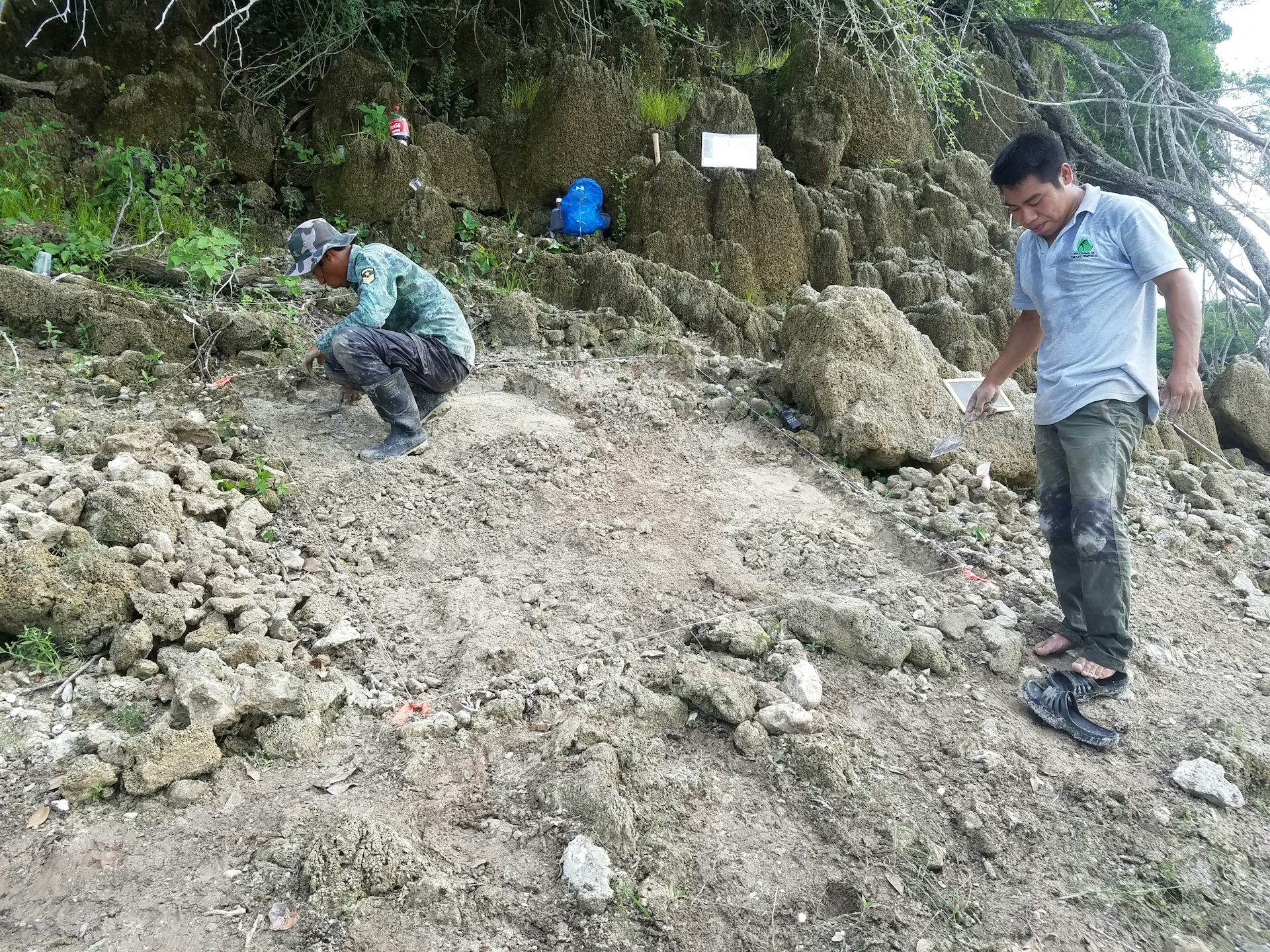
In 2015, journalist Douglas Preston sparked a media frenzy with a National Geographic report on archaeological activity in the La Mosquitia region of Honduras. He was part of a research team that used aerial lidar and claimed that his team had discovered a “lost city” in Honduras, commonly referred to as Ciudad Blanca, or the White City. Mr Preston described the newly mapped settlements and surrounding areas as “remote, uninhabited land, little studied and virtually unknown”.
you may like
While Preston’s comments could be dismissed as another saga to popularize archeology, many point to a more troubling effect.
The Miskitu people have lived in La Mosquitia since ancient times and have always known about the ruins in their ancestral homeland. In what some have called the “Christopher Columbus syndrome,” such stories of discovery erase Indigenous presence, knowledge, and agency, while simultaneously enabling dispossession.
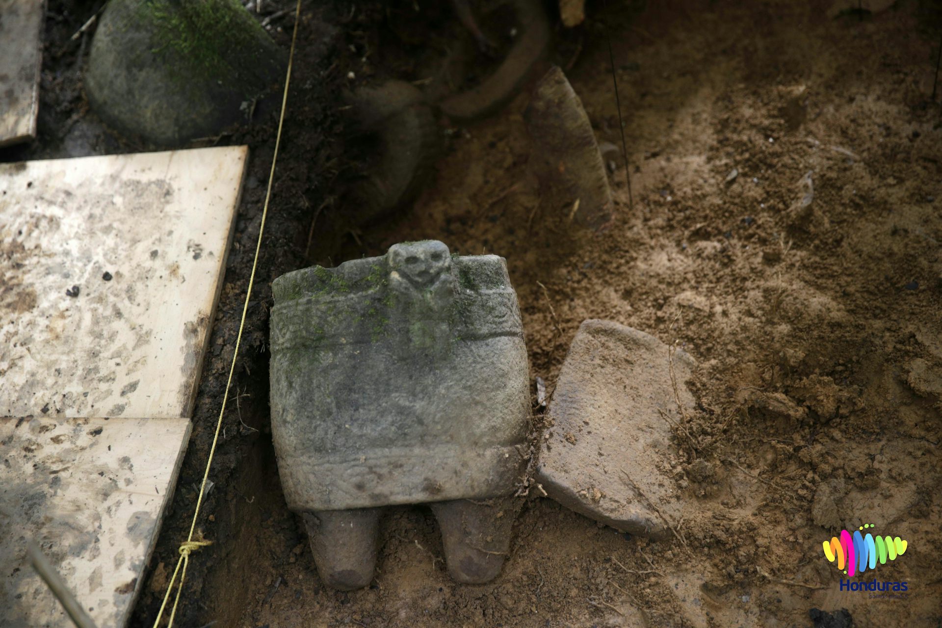
Media hype led to an expedition that included then Honduran President Juan Orlando Hernández, who was pardoned for drug trafficking by US President Donald Trump in 2025. Expedition members removed artifacts from La Mosquitia without consulting or obtaining the consent of the indigenous people living in the area.
In response, MASTA (Mosquitia Asura Takanka – Unification of La Mosquitia), an organization run by the Mosquitu tribe, issued the following statement:
“we [MASTA] Calls for the application of relevant international agreements/instruments to a prior, free and informed consultation process in Muskitia in order to formalize the protection and conservation model proposed by indigenous peoples; ”
However, their requests appear to have been largely ignored.
The La Mosquitia controversy is an example of a global struggle. Colonialism has changed the landscape somewhat, but it is not over, and Indigenous peoples have continued to fight back for generations. Today, supported by frameworks such as the United Nations Declaration on the Rights of Indigenous Peoples and International Labor Organization Convention No. 169, there is a growing call for consent and cooperation in research on indigenous lands and heritage.
How to move forward together
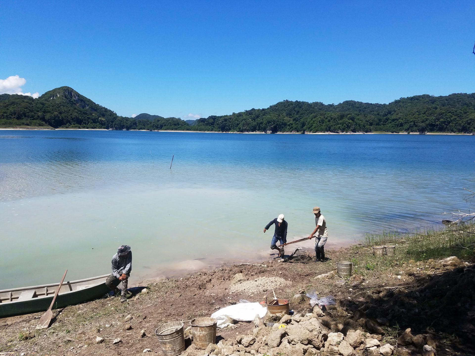
Despite the dilemmas posed by aerial lidar mapping, I argue that it is possible to use this technology in ways that promote Indigenous agency, autonomy, and well-being. As part of the Mensabag Archeology Project, I partnered with the Haha Winik people (known to outsiders as the Lacandon Maya) of Puerto Bello Metzabok, Chiapas, Mexico, to conduct archaeological research.
Metsabok is part of a UNESCO Biosphere Reserve, and research often requires multiple federal permits. From Hatch Winnik’s perspective, local people protect a living, conscious forest rather than an objectified nature. The land is co-owned by Huck Winnik under an agreement with the Mexican federal government.
Based on the collaborative methodology of the Mensabak Archeology Project, we developed and implemented a culturally sensitive informed consent process before conducting aerial laser scanning.
In 2018, I spoke via Whatsapp with a leader in the Metzabok community called Comisario to discuss research possibilities, including the possibility of an air lidar survey. We agreed to meet in person, and after an initial discussion, the Commissario convened a “meeting,” a public forum in which community members formally deliberated on issues that affected them.
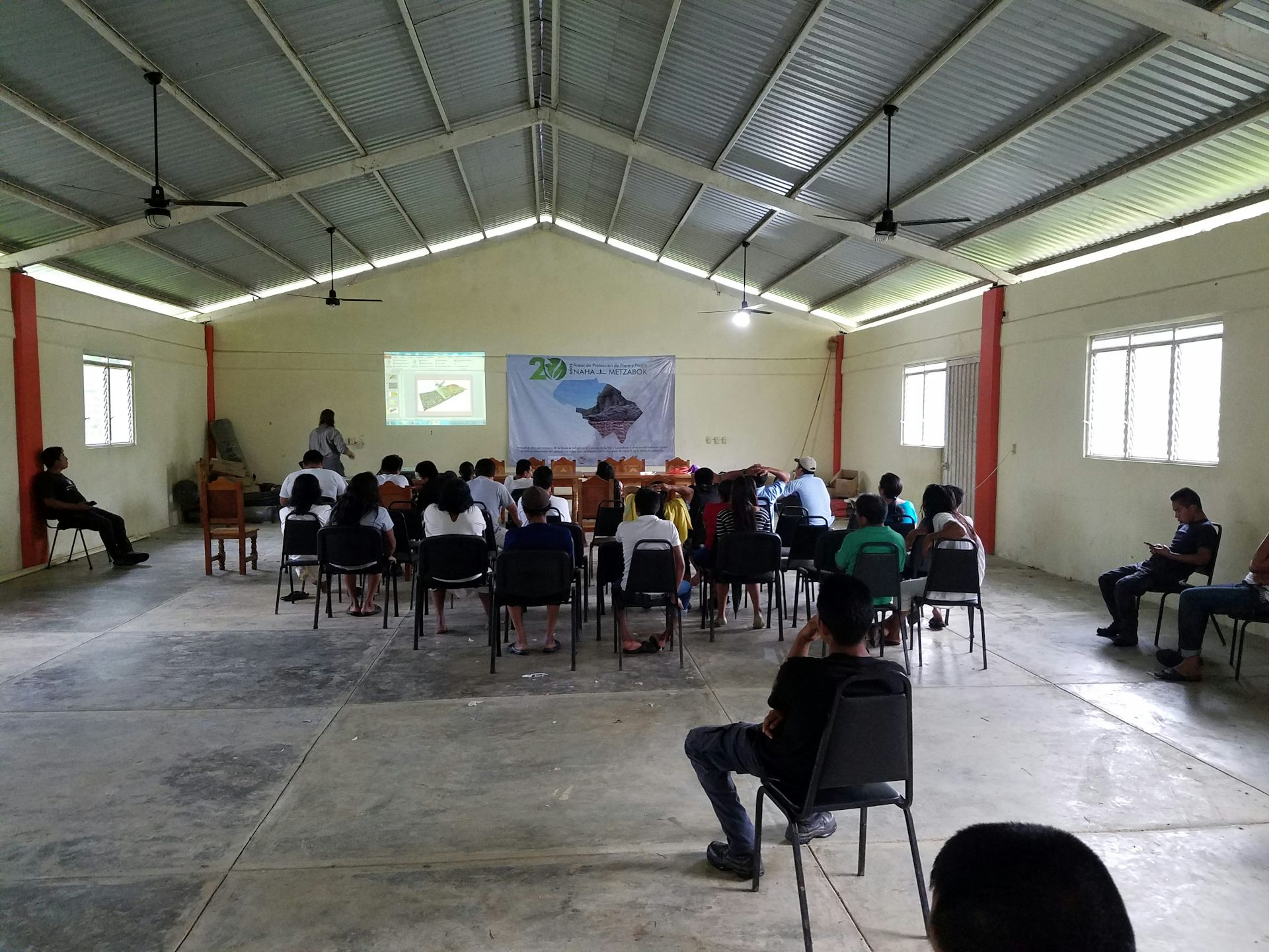
At Assemblea, Joel Palca, founder of the Mensabak Archeology Project, and I presented our past and proposed research. Local colleagues encouraged the use of attractive images and helped explain concepts using a combination of Spanish and Haha Winik language, Haha Tan. Palka is fluent in Hattanese and Spanish, so he was able to participate in all discussions.
Importantly, we made sure to discuss the potential benefits and risks of any proposed survey, including aerial scanning of the community.
The question and answer section was also lively. Many participants said they felt there was value in mapping the forest and the ground beneath the canopy. Community members saw LIDAR as a way to document their territory and even promote responsible tourism. There was some hesitation about the possibility of increased looting due to media attention and the federal government releasing some map data. But most felt prepared for that possibility thanks to decades of experience protecting forests.
Eventually, the community officially agreed to proceed. Still, consent is an ongoing process and must be prepared to be stopped at any time if consenting parties withdraw their permission.
Air lidar benefits all parties
In my experience, archaeologists too often remain unaware or defensive when faced with issues of Indigenous oppression and consent in air lidar research.
But another path is also possible. Obtaining culturally sensitive informed consent may become standard practice in aerial lidar research. Indigenous communities can become active collaborators rather than being treated as passive subjects.
At Metsaboku, the aerial mapping project was an act of relationship building. We have demonstrated that cutting-edge science can be reconciled with Indigenous autonomy and well-being when based on dialogue, transparency, respect, and consent.
The real challenge is not whether we can map faster or in more detail, but whether researchers can do so fairly, humanely, and with greater accountability to the people whose lands and ancestral remains we study. Done right, aerial lidar could spark a real revolution that connects Western science and technology with the future of indigenous peoples.
This edited article is republished from The Conversation under a Creative Commons license. Read the original article.
Source link