A new study shows that tectonic movements and the “ghosts” of past ice sheets are warping, lifting and pulling Greenland in different directions.
Greenland sits on top of the North American tectonic plate, which has dragged the island northwest by 0.9 inches (23 millimeters) per year for the past 20 years. Researchers have been monitoring this drift for some time, but a new study analyzing satellite data shows there’s much more to this movement and other deformations than plate tectonics.
you may like
Berg and his colleagues analyzed data from 58 Global Network Satellite System (GNSS) stations in Greenland that record Greenland’s horizontal and vertical movements, as well as approximately 2,900 GNSS stations around the North American plate. When the researchers fed these data into their model and removed the influence of the North American plate on Greenland, they were left with areas of rock deformation, or stretches and contractions of the Earth’s crust, that were inconsistent with previous modeling.
In most regions, landmass movement is overwhelmingly controlled by tectonic movements. But Greenland is different. That’s because Greenland is covered by a huge ice sheet and has a turbulent glacial past, according to a study published Aug. 28 in the Journal of Geophysical Research: Solid Earth.
Ice sheets pile up enormous weight on the Earth’s crust, pushing it down into the mantle, the planet’s layer beneath the crust. According to Berg, material displaced within the mantle by the subsidence of the Earth’s crust is pushed to the sides, forming what is known as a peripheral prebulge.
When the ice sheet retreats, the mantle does not immediately return to its original shape. Because the mantle is so viscous, it takes thousands of years for material to flow back into the depressions created by the stacked crust. In other words, Mantle “has a very long memory,” Berg said.
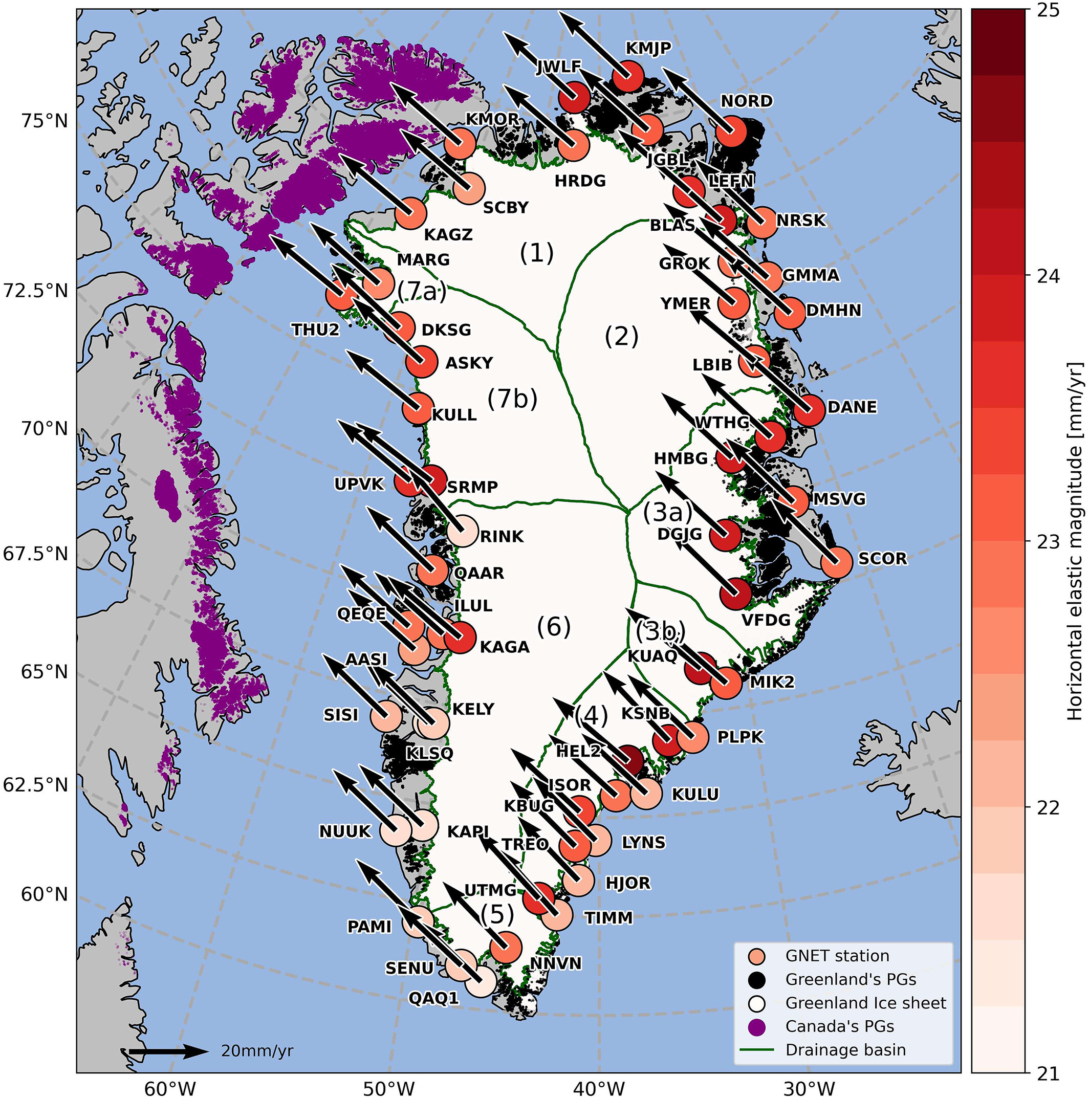
Greenland’s subsurface and surrounding mantle are still adapting to changes in ice cover since the peak of the last ice age about 20,000 years ago, explaining why the data show the island deforming. Specifically, Greenland appears to be responding to the retreat of the Laurentide Ice Sheet, which covered large areas of North America until about 8,000 years ago.
The Laurentide Ice Sheet formed a peripheral foreridge beneath parts of Greenland. The bulge is gradually flattening, pulling an area of southern Greenland downward and toward Canada, Berg said. Researchers already knew this, but the new results reveal that the deformation rate is higher than most modeling suggests, he said.
Greenland’s ice sheet also plays a role in the island’s twisting motion. Meltwater from ice sheets contributed 13.5 feet (4.1 meters) of the 430 feet (130 meters) of sea level rise recorded over the past 20,000 years, Berg said. This means Greenland has lost an incredible amount of ice, causing a mantle response that is separate from the effects of the Laurentide ice sheet, he said.
The melting of Greenland’s ice sheet has accelerated in recent years due to climate change. Past and present ice mass loss on Greenland has had similar effects across the island, pushing rock outward and upward, Berg said.
The results provide the most detailed picture of Greenland’s progress to date, particularly how the island is shrinking in some places, the statement said. The discovery is important because it provides new insights into how polar regions respond to climate change, which can distort maps used for navigation and research, Berg said.
“In conjunction with other types”[s] “Results from satellite observations could provide new information about past ice sheets and Earth’s structure,” he added.
Source link